Skip to content
  • Home
  • Travel Blog
    • Jasper & Pyramid Lake, Alberta
    • Medicine, Maligne Lakes & Spirit Island
    • Mt. Edith Cavell & Angel Glacier
    • Columbia Icefields Parkway
    • Lakes in the Mountains
    • Lake Louise
    • Banff National Park
    • Ronda, Andalusia, Spain
    • Ancient Walbran Forest
    • October day in Herm Island
    • Eagles at Oyster Bay, Quadra & Cortes Islands
    • Montreal,Quebec Canada
    • The Sunshine Coast
    • Beautiful Gabriola island
    • Dog walk, Crescent beach, Whiterock
    • White Rock – British Coloumbia
    • What is it about rainbows?
    • Winter Home in Gabriola Island
    • Sunset on flight to Vancouver
    • New Dawn, New Adventure
  • Galleries
    • CANADA
      • GABRIOLA ISLAND – BC
      • NANAIMO B.C.
      • PORT ALICE
      • PORT McNEILL & TELEGRAPH COVE
      • THE PACIFIC RIM is on the west coast of Vancouver Island
      • ICE FIELDS
    • WILDLIFE PHOTOS
      • BALD EAGLES
      • HERONS
      • BEARS
      • A VARIETY OF BIRDS
    • PEACEFUL, TRANQUIL IMAGES
    • NIGHT IMAGES
    • Trees – branching into nature
  • Products
    • ePhoto Books
    • Quality Photo Cards
    • Photo Store
    • Fine Art Store
  • Contact
  • Newsletter

7. Jasper & Pyramid Lake, Alberta

31 Aug 2019
GrahamJasper Nation Park

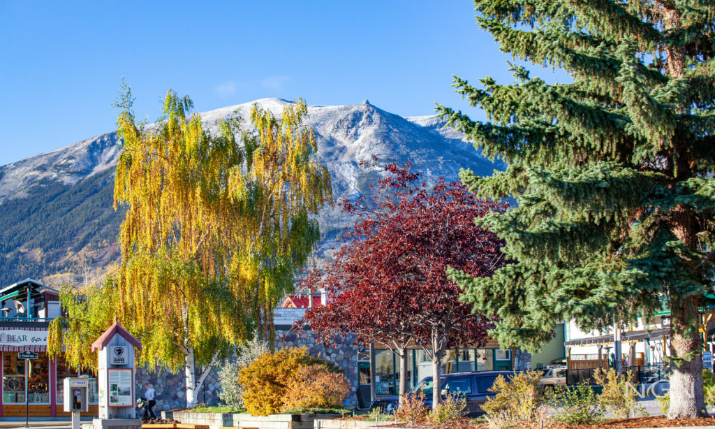
The first recorded visit to the Athabasca Valley was by surveyor David Thompson in 1810. The North West Company built a supply depot on Brule Lake in 1813, a settlement which later became known as Jasper House after North West Company clerk Jasper Haws. With the decline of the fur trade, Jasper House was abandoned in 1884. The Dominion Government established Jasper Forest Park in 1907, setting aside an area of some 13,000 square kilometers. By 1911, the Grand Trunk Pacific Railway had reached Fitzhugh (now Jasper) Station. The Jasper-Edmonton road opened in 1928. 
 Icefields Parkway opened in 1940, connecting Lake Louise and Jasper.

MunicipalityDistance
Banff287 kilometres
Calgary414 kilometres
Edmonton363 kilometres
Kamloops443 kilometres
Lake Louise
232 kilometres
Pyramid Mountain Reflection

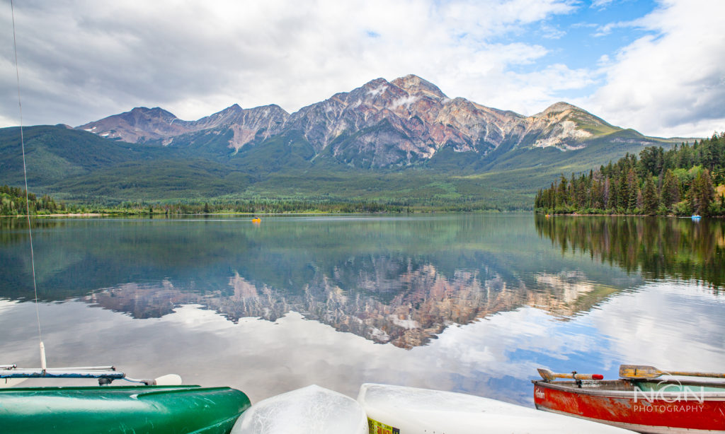
Pyramid Lake lies at the foot of Pyramid Mountain, a natural landmark that overlooks the town of Jasper. It has a total area of 1.2 km2 (0.46 sq mi) and discharges in Athabasca River through the 2 km (1.2 mi) long Pyramid Creek. There are several picnic sites on the shores of the lake, as well as boat ramps. Pyramid Lake Resort is located on the southeast point of the lake. Pyramid Island is a short distance from the resort, there is a small parking area which can be accessed by a road or hiking trails, then you cross a small wood foot bridge to the island itself, which has benches, picnic tables and a small open wooden shelter. When I was there there was a wedding taking place on the island. Pyramid Lake is connected to the town of Jasper by Pyramid Lake Road and hiking trails, as well as hiking trails to other tourist sites such as Pyramid Mountain.

Post navigation

6. Medicine, Maligne Lakes & Spirit Island

NGN Photography

Graham Neville is a keen photographer who has lived in Guernsey, Channel Isles for the last 45 years. Since retiring his travels have taken him to Japan, Egypt, Europe, throughout the UK and many states of USA. He has had several extended visits to Canada experiencing all seasons in British Columbia and Alberta. He specialises in landscape, travel, nature and wild life photography.

Recent Posts

  • 7. Jasper & Pyramid Lake, Alberta
  • 6. Medicine, Maligne Lakes & Spirit Island
  • 5. Mt. Edith Cavell & Angel Glacier
  • Columbia Icefields Parkway
  • 3. Lakes in the Mountains
  • 2. Beautiful Lake Louise
  • 1. Banff National Park
  • Ronda in Andalusia, Spain
  • An October day in Herm Island
  • Montreal Quebec Provence Canada
  • Ancient Walbran Forest, BC Under-threat
  • Eagles at Oyster Bay, Quadra & Cortes Islands

Photos

  • A VARIETY OF BIRDS
  • BEARS
  • ePhoto Books
  • GABRIOLA ISLAND – BC
  • GUERNSEY MY ISLAND HOME
  • NANAIMO B.C.
  • Newsletter
  • NIGHT IMAGES
  • PEACEFUL, TRANQUIL IMAGES
    • THE NATURE of TREES
  • PORT ALICE
  • PORT McNEILL & TELEGRAPH COVE
  • Quality Photo Cards
  • THE PACIFIC RIM is on the west coast of Vancouver Island
  • BALD EAGLES
  • HERONS

© All right reserved 2017

Medical Circle by Acme Themes
  • A VARIETY OF BIRDS
  • BEARS
  • Contact
  • ePhoto Books
  • GABRIOLA ISLAND – BC
  • GUERNSEY MY ISLAND HOME
  • Home Page
  • ICE FIELDS
  • NANAIMO B.C.
  • Newsletter
  • NIGHT IMAGES
  • PEACEFUL, TRANQUIL IMAGES
  • PORT ALICE
  • PORT McNEILL & TELEGRAPH COVE
  • Quality Photo Cards
  • Site-Wide Activity
  • THE PACIFIC RIM is on the west coast of Vancouver Island
  • WILDLIFE PHOTOS
Visit Us On FacebookVisit Us On YoutubeVisit Us On Linkedin